Trails
The Shire of Beverley provides a fantastic opportunity for a wide range of trails with its varied landscapes and great diversity in vegetation and agricultural practices. All of this within close proximity to Perth.
Avondale Bush Reserve Walk Trail
|
Note: This trail is currently only accessible by appointment. Please contact National Trust of WA (08) 9321 6088.
The Bush Reserve Trail is marked with a total distance of 1.8km. No hiking experience is needed however a reasonable level of fitness is required. It is recommended to allow an hour to walk the loop. On the trail you will discover an abundance of flora and fauna. |
More Information
Contact the National Trust of WA National Trust of WA: (08)9321 6088 Email: [email protected] The picking of wildflowers is prohibited by law in Western Australia. |
Avondale Drive Trail
|
Note: This trail is currently only accessible by appointment. Please contact National Trust of WA (08) 9321 6088.
The Drive Trail at Avondale Farm is 5km, however this will take longer than you expect with a speed limit of 15kph and much to see. Just over halfway through the trail you will get to the Avondale Bush Reserve Trail, so jump out and stretch your legs for a walk through the Bush Reserve. |
More Information
Contact the National Trust of WA National Trust of WA: (08)9321 6088 Email: [email protected] The picking of wildflowers is prohibited by law in Western Australia. |
Beverley Play Trail
|
This play trail follows eight (8) points in the town of Beverley and highlights historical sites, community assets and beautiful public art. It is a trail for the whole family to enjoy! This walk will take around one and a half (1.5) hours to complete, and is two and half (2.5) kilometres return. We suggest visiting the Beverley Visitor Centre along the way to learn more about the town. We recommend parents remain with children to complete this trail as one of the stops requires users to cross a main road. |
Brooking Street Bush Reserve Trails |
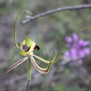
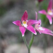
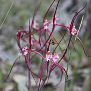
The Brooking Street Bush Reserve trails are walking distance from the main street and just around the corner from the RV Park. The reserve is a small but bountiful Bush Reserve. The reserve has over 12 native orchid species of which many are seen from July - October. The hybrid pink fairy and cowslip orchid is a species that attracts many. Trails WA website link here. |
More Information Turn right off Vincent St onto Brooking Street. Turn right onto the gravel track where parking is available in the reserve. Please do not park at the Water standpipe on Brooking St. Click here for map The picking of wildflowers is prohibited by law in Western Australia. Trails WA website |
Christmas Tree Well Walk
|
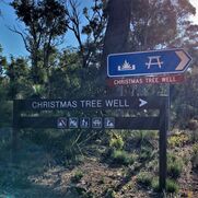
The Christmas Tree Well Walk is a relatively easy walk that is about 12km in length. Ensure that you carry with you water and the essentials. There is a picnic area near the start of a walk trail which leads to the picturesque walk through Wandoo Bushland. |
More Information
Brookton Highway, Flint. Located 20km from the Westdale / Brookton Highway turnoff. www.walkgps.com.au/walk/christmas-tree-well/ |
County Peak Trail
|
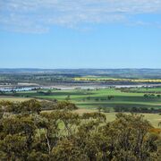
Currently there are no formal walk trails at the site. An accessible drive trail loops around the peak. For those that wish to hike to the summit, views at the top are breath-taking. From the peak seven Shires can be seen including Beverley, Brookton, Pingelly, Corrigin, Quairading, Kellerberrin and York and the expansive Yenyening Lakes system can be seen.
|
More Information
Click here for more information on County Peak Contact the Beverley Visitors Centre (08)9646 1555 |
Dale River Reserve
|
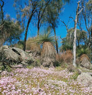
A hidden gem in the Avon Valley. The Dale River reserve is located around 20km from the Beverley townsite off Westdale Road. Located along the Dale River the reserve is a biodiversity hotspot for birdlife and native vegetation. There are two relatively easy walk trails under 1km from the main pool site. The wildflower loop which is best to walk in August and September and a river walk.
|
More Information
From Townsite head south on Great Southern Highway. Turn right onto Westdale Road. Further along Westdale there is a left turn onto Deep Pool Road. Head south on the gravel road for 4km which goes through private properties, the reserve is sign posted on the right. Click here for the map |
Geocache Trail - Wandoo Series
|
Not sure what geocaching is about? Go through the links to the Official Geocaching website. Beware.... you may get hooked! You will need to signup to be a member, however there is a whole new world ready to be explored.
The Wandoo Series is a trail that takes you through the Wandoo Bushlands from Karragullen to Beverley and York. This series of Geocache cover around 300km, but no need to do them all at once! |
Geocaching Trail - FOTT Go Bush
|
Not sure what geocaching is about? Go through the links to the Official Geocaching website. Beware.... you may get hooked! You will need to signup to be a member, however there is a whole new world ready to be explored.
The FOTT Go Bush is a geoart trail that takes you on adventure through the Wandoo Bushland. Some preparation is required before tackling this trail. There are varying levels of terrain, some requiring 4WD. |
Vincent Street Heritage Walk
|
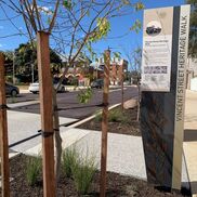
This award-winning trail guides you on a tour of the stunning heritage buildings in Beverley. Download the app by scanning the QR code at the trail head just outside the Beverley Visitor centre.
As you walk along Vincent Street pedestals will be found outside the buildings of significance or follow the map on the Augmented app reality app. Each identified place has cultural significance to the Beverley community. |

